Aerial & Topographic Mapping
Back to Specialist ServicesWe provide high-resolution aerial imagery and topographic mapping to support planning, design, and land analysis across a wide range of projects.
Land Surveying and Mapping Services
We provide high-resolution aerial imagery and topographic mapping to support planning, design, and land analysis across a wide range of projects.
Aerial and topographic mapping provides a clear view of land and surface features, supporting informed decision-making at every stage of a project.
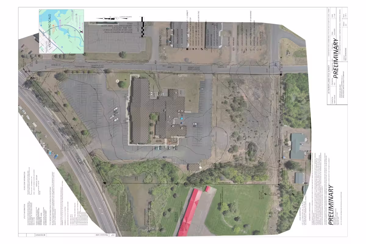
Using high-resolution aerial and satellite imagery alongside survey data, we create detailed maps that capture terrain, elevation, and existing site features. Topographic mapping represents changes in elevation through contouring and modelling, giving a precise understanding of the landscape.
These maps are used for site planning, development, environmental analysis, and infrastructure design. By combining imagery with accurate spatial data, we provide a reliable foundation for evaluating land use, identifying constraints, and planning future work.
Outputs can include aerial imagery, contour maps, and digital terrain models, delivered in a range of formats suitable for design, analysis, and integration with GIS and CAD systems.