Land Surveying
Back to HomeOur team provides comprehensive surveying services for residential, commercial, and industrial projects. From land acquisition through to construction layouts, we provide survey data to support each stage of a project.
Land Surveying and Mapping Services
Our team provides comprehensive surveying services for residential, commercial, and industrial projects. From land acquisition through to construction layouts, we provide survey data to support each stage of a project.
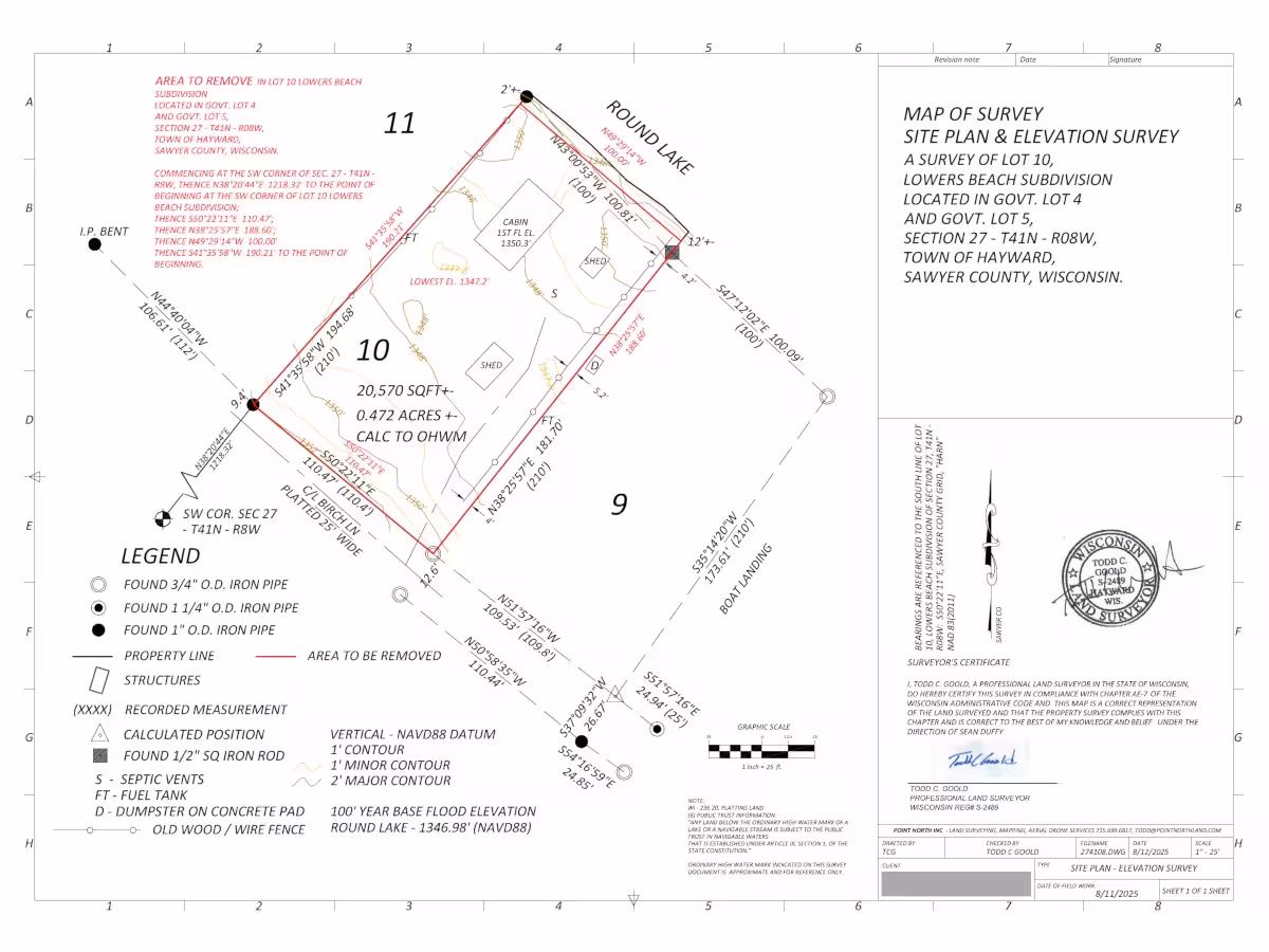
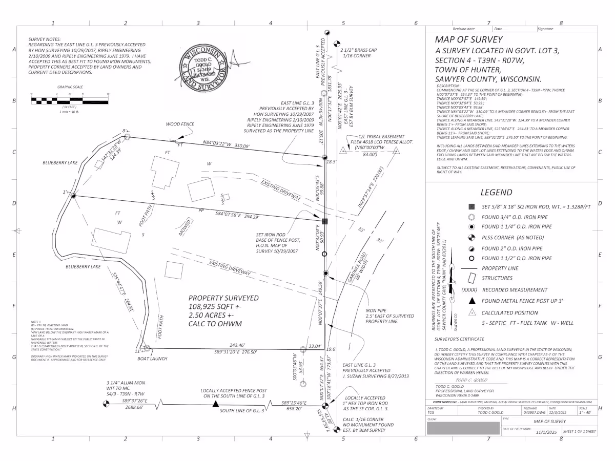
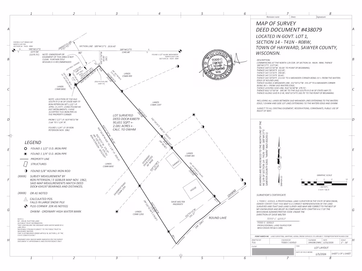
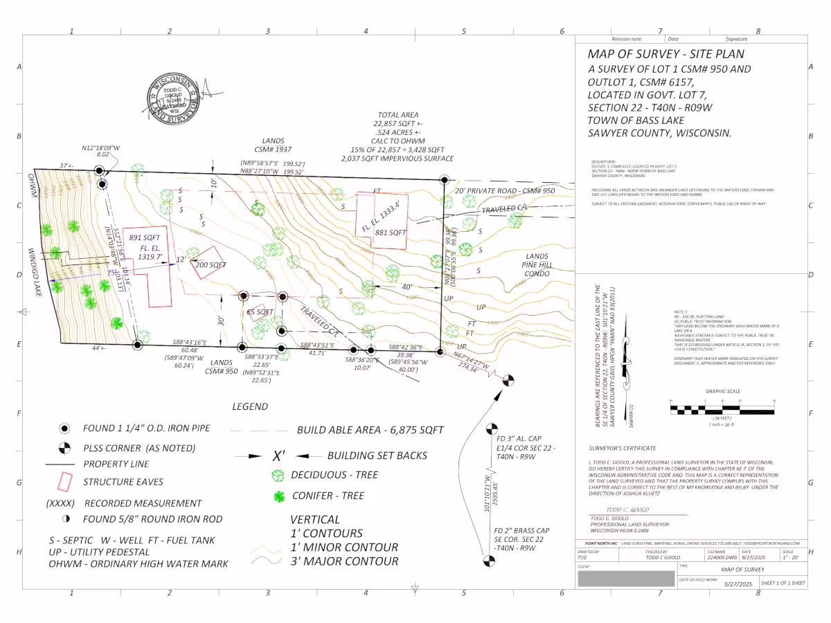
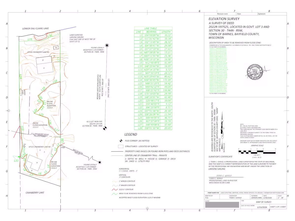
Boundary surveys define the exact property lines and corners of a parcel of land, ensuring legal clarity and avoiding future disputes.
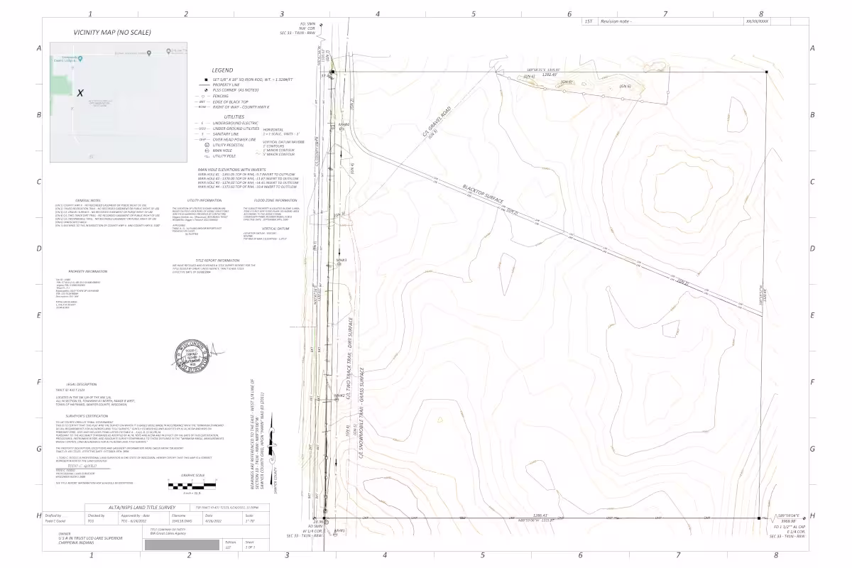
The most comprehensive type of land survey used in U.S. real estate, protecting buyers, lenders, and title companies by documenting both physical property features and legal rights.
A legal land division survey used to create new parcels, adjust lot lines, and prepare property descriptions for development or transfer.
We also provide a wide range of boundary surveying services for residential, commercial, and development projects:
Construction surveys provide the exact locations for structures, utilities, and machinery to ensure projects are constructed in accordance with design plans.
A record of completed construction, confirming that buildings, utilities, and site features have been installed in the correct location and elevation.
We also provide the following construction-related surveys to support your project from start to finish:
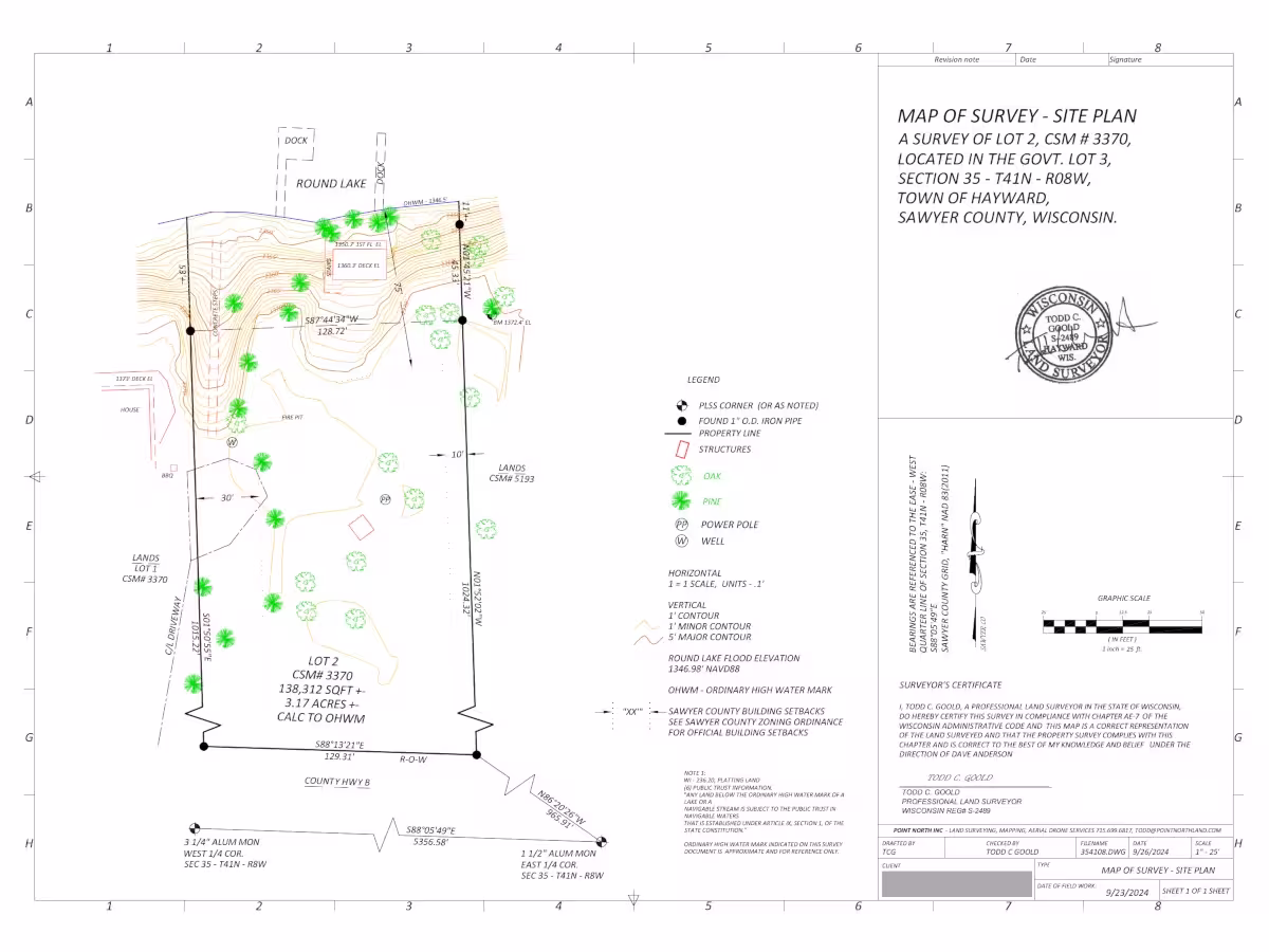
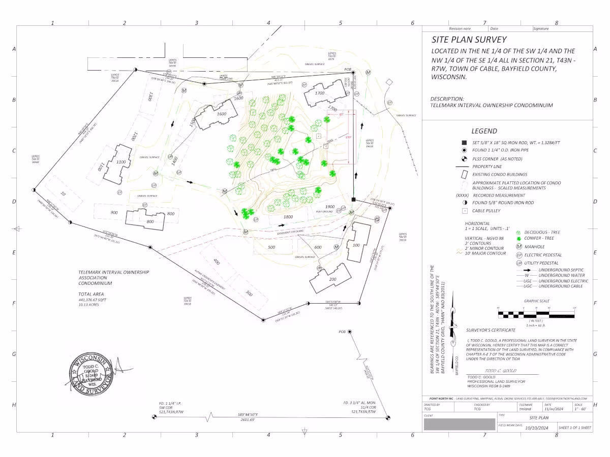
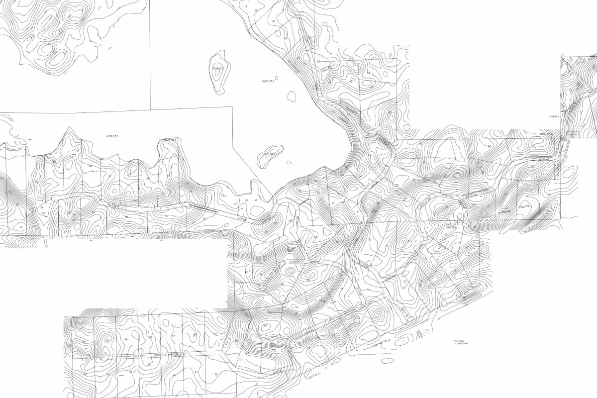
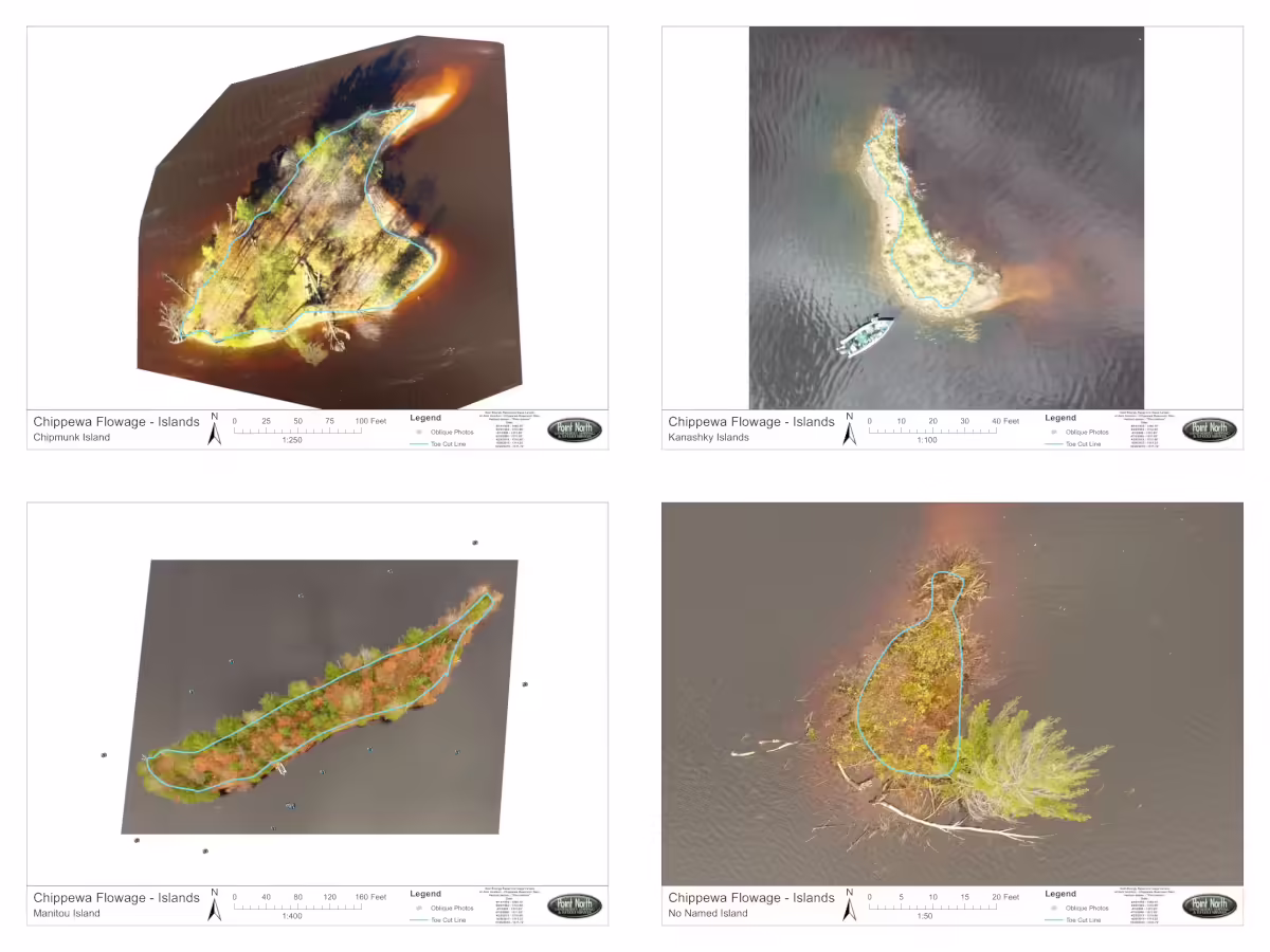
Topographic surveys provide detailed maps of the land's contours, elevations, and existing features to support design and planning.
We offer additional surveying services for unique requirements, ensuring precision and regulatory compliance for all project types.