What is a Certified Survey Map?
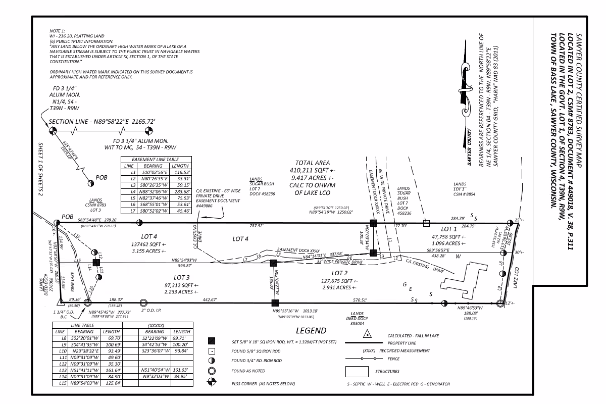
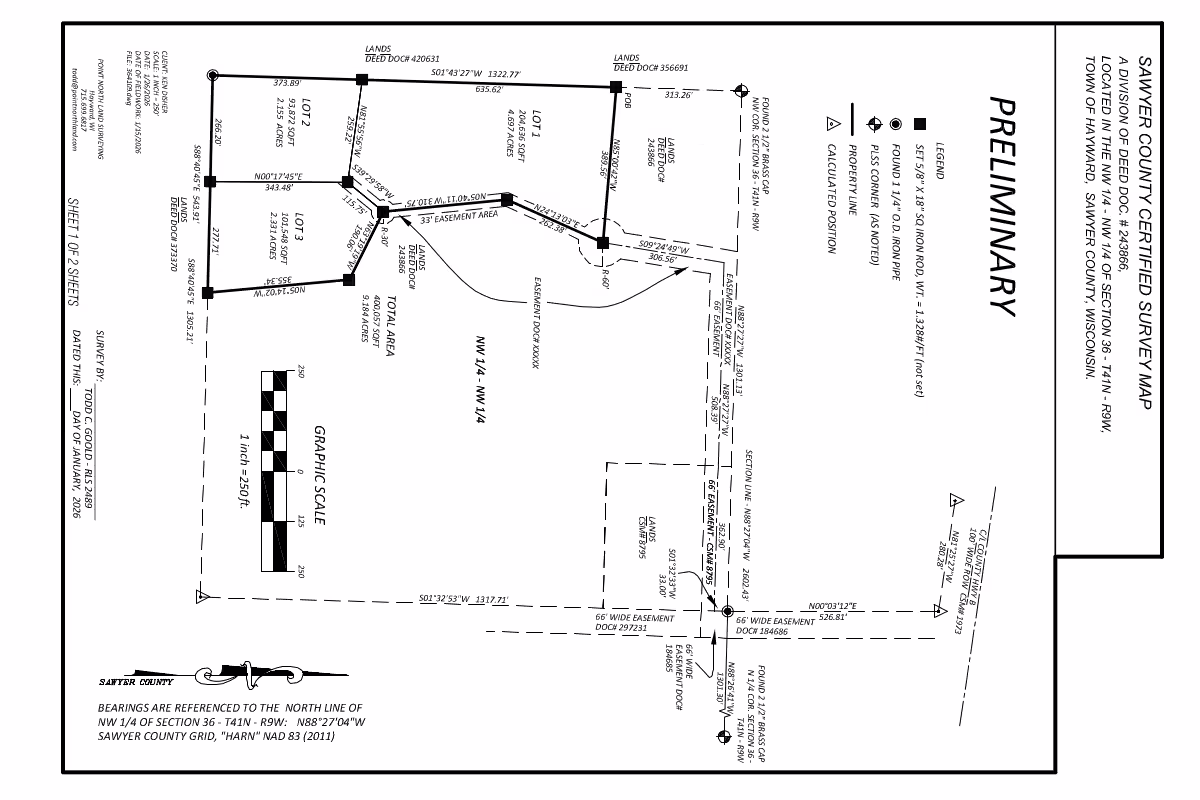
A Certified Survey Map (CSM) is a legal land division document used to create new parcels of land. In Wisconsin, CSMs are commonly used to divide property into a limited number of lots without going through the full subdivision plat process.
A CSM is prepared by a licensed professional land surveyor and recorded with the county register of deeds. The map defines the new property boundaries and provides the legal descriptions needed for ownership, development, and future land transactions.
When a CSM is Used
Certified Survey Maps are often used when property owners want to divide land into smaller parcels for sale, development, or transfer of ownership.
Common uses include:
- Creating new residential lots
- Splitting land between family members
- Dividing commercial or industrial property
- Adjusting lot lines between neighboring parcels
- Creating buildable lots for future development
What a Certified Survey Map Shows
Property Boundaries
- New parcel lines
- Boundary dimensions
- Monuments and corner markers
Access & Easements
- Road frontage
- Ingress and egress access
- Utility or drainage easements
Legal Descriptions
- Descriptions for each parcel
- Survey certifications
- Recorded map references
Existing Features
- Buildings and improvements
- Roads and driveways
- Visible utilities and occupation lines
Why a CSM is Important
A properly prepared CSM helps ensure that newly created parcels comply with local zoning, access, and land division requirements.
It also helps:
- Clearly define ownership boundaries
- Reduce the risk of future boundary disputes
- Provide legal descriptions for deeds and title work
- Support permitting and future development
The CSM Process
A typical Certified Survey Map project includes:
- Researching existing deeds and property records
- Performing field measurements and boundary analysis
- Preparing the Certified Survey Map and legal descriptions
- Submitting the map for local review and approval
- Recording the completed CSM with the county