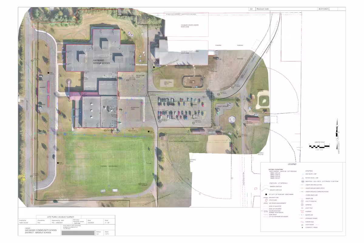
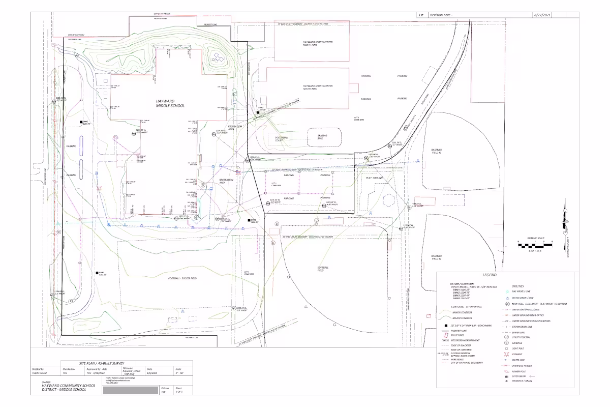
What is an As-Built Survey
An as-built survey, also called a record survey or as-constructed survey, documents what was built on a site, showing the real-world location of improvements compared to the design plans. It is typically performed by a licensed land surveyor once construction is complete or during major phases of construction.
Purpose of an As-Built Survey
Construction plans show what was intended, while an as-built survey shows what actually exists. Because construction rarely matches the plans perfectly, it provides a clear record of what was built on site.
Key elements the survey verifies:
- Whether structures were built in the correct location
- If improvements comply with setback requirements and zoning rules
- Whether infrastructure was installed at the proper elevations and alignments
The survey becomes part of the permanent project record.
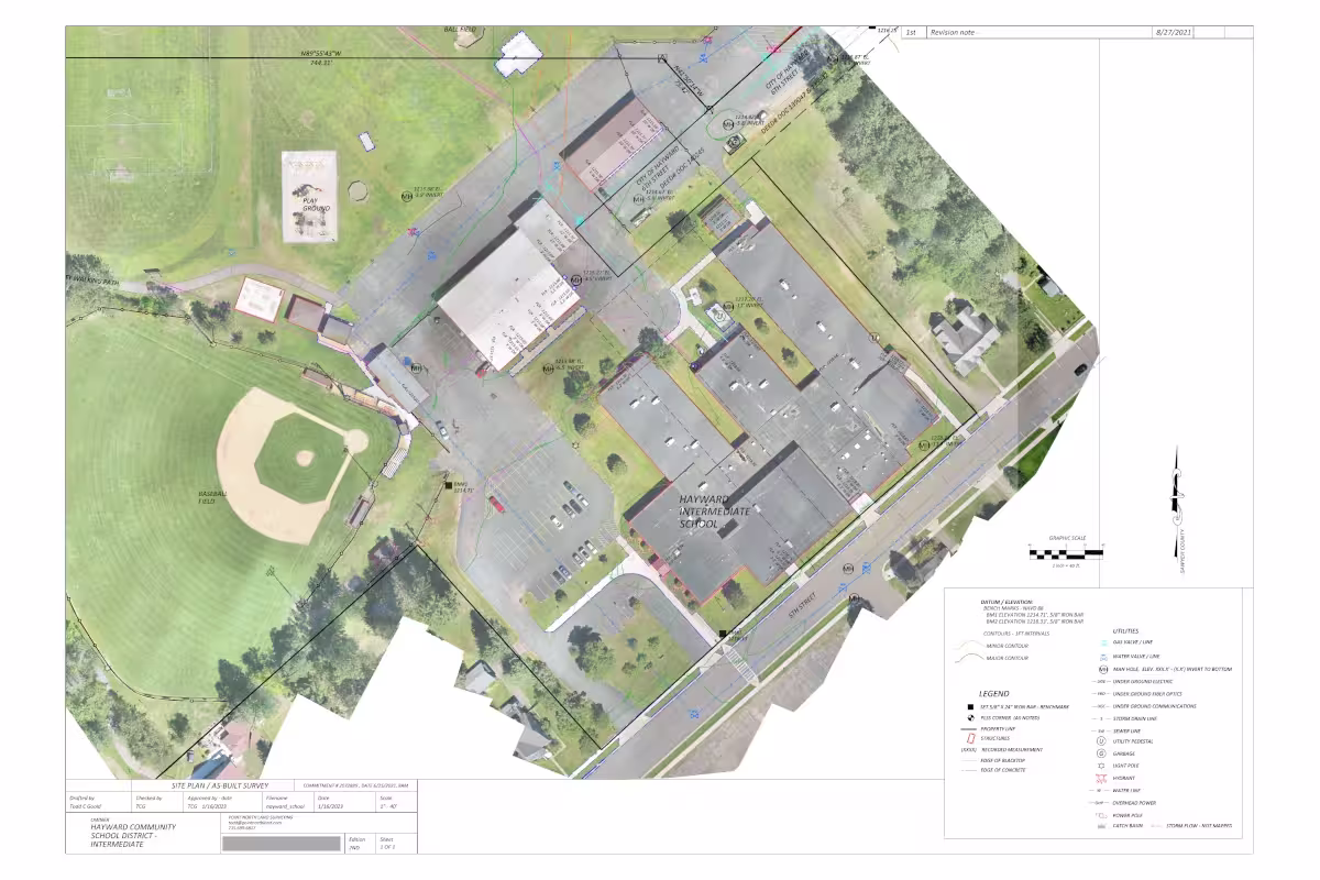
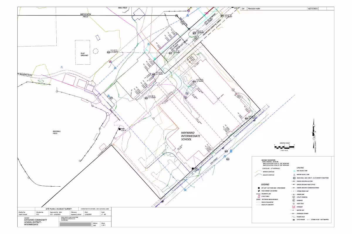
What an As-Built Survey Measures
An as-built survey typically documents the position and elevation of major site features such as:
Buildings and Structures
- Building footprints
- Foundations
- Exterior walls
- Overhangs
Site Improvements
- Parking lots and driveways
- Sidewalks and curbs
- Retaining walls
- Fences
Utilities and Infrastructure
- Stormwater systems
- Manholes and catch basins
- Water and sewer lines
- Fire hydrants
Elevations
- Finished floor elevation
- Top of curb
- Drainage structures
- Grading surfaces
These measurements are usually tied to survey control points or benchmarks for accuracy.
Why As-Built Surveys Are Required
Local governments, engineers, and developers rely on as-built surveys to verify compliance with approved plans.
They are commonly required for:
- Construction verification - Ensures buildings meet approved site plans and permits.
- Municipal approvals - Cities often require them before issuing certificates of occupancy.
- Infrastructure acceptance - Public agencies use them before accepting roads, utilities, or stormwater systems.
- Engineering records - Civil engineers use them to update project drawings.
When They Are Performed
As-built surveys may occur at several stages:
- Foundation stage - verifies building placement before vertical construction continues
- During construction - checks infrastructure installations
- Final as-built survey - completed after the entire project is finished
Large infrastructure projects sometimes produce multiple interim as-built surveys.
What the Final Deliverable Looks Like
The final deliverable is usually:
- A survey drawing or CAD file
- Showing actual measured positions of improvements
- With dimensions and elevations
- Often stamped by a licensed surveyor
Many modern projects also include:
- Digital CAD files
- GIS data
- 3D point clouds from laser scanning or drones
As-Built Survey vs Other Surveys
Survey Type
When Done
Purpose
Property purchase/refinancing
Detailed title & boundary survey for real estate transactions
As-built survey
After or during construction
Documents what was actually constructed