Bathymetric Surveys
Back to Specialist ServicesBathymetric surveys measure water depth and underwater terrain, providing accurate data for planning, design, and analysis of lakes, rivers, and other water bodies.
Land Surveying and Mapping Services
Bathymetric surveys measure water depth and underwater terrain, providing accurate data for planning, design, and analysis of lakes, rivers, and other water bodies.
Bathymetric surveying is the process of measuring water depth and mapping the shape of the land beneath the surface. Similar to topographic surveys on land, it provides a clear picture of underwater features and contours.
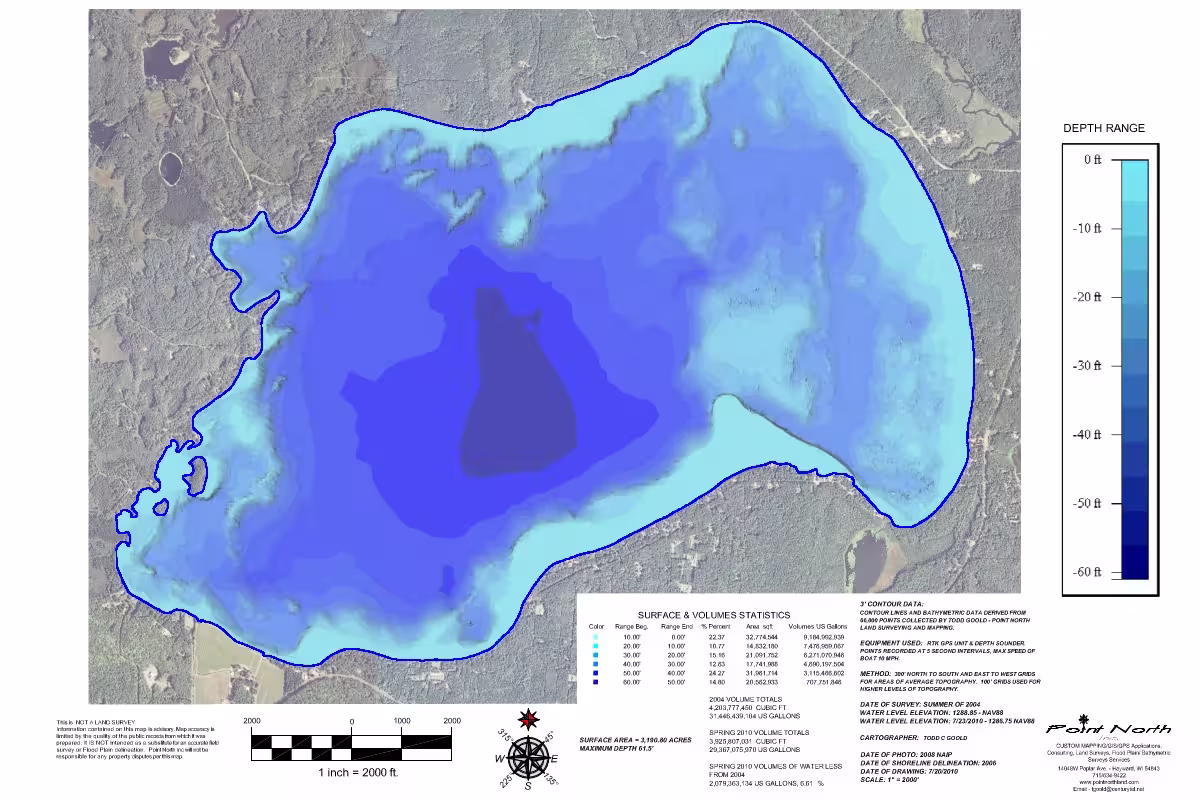
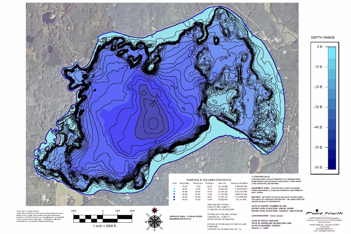
Using GPS positioning and echo sounding technology, we collect depth data across a water body to create accurate maps and models of the lake or river bed. This information supports a wide range of environmental, engineering, and recreational projects.
Bathymetric surveys are commonly used for dredging projects, environmental monitoring, shoreline management, and the development of waterfront or recreational areas. The resulting data can also be used to calculate water volume, analyse sediment build-up, and better understand underwater conditions.