
Custom Mapping For The Land Owner, Sportsmen, And Recreational User


Lake Maps
What is Bathymetry?
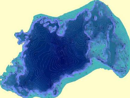
Bathymetry is the measurement of the depths of water bodies from the water surface. It's the lake equivalent to topography.
Bathymetric surveys are generally conducted with a transducer which both transmits a sound pulse from the water surface and records that same signal when it bounces from the bottom of the water body. An echosounder attached to the transducer filters and records the travel time of the pulse. At the same time that the pulse occurs, a GPS unit can record the X,Y location of the reading.
After many of these readings are taken usually set to a 5 second interval, corrections are made based on fluctuations in the water surface elevation that may have occurred during the survey. The individual points are then mapped.
Bathymetric Survey uses:
- Check on the efficiency of dredging operations
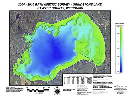
- Re-create or create the lake bed topography
- Surface and Volume statistics
© Copyright Point North Land Surveying and Mapping Inc. All rights reserved.
CREATE A MAP

CONTACT