
Custom Mapping For The Land Owner, Sportsmen, And Recreational User


Land Surveying
Point North Land offers a full suite of land surveying options:
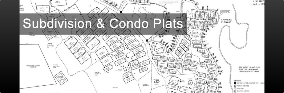
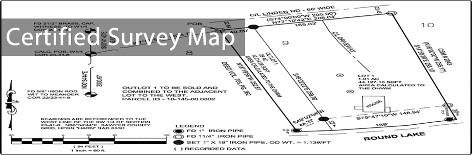
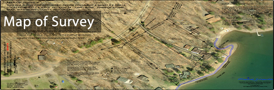
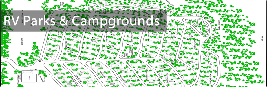
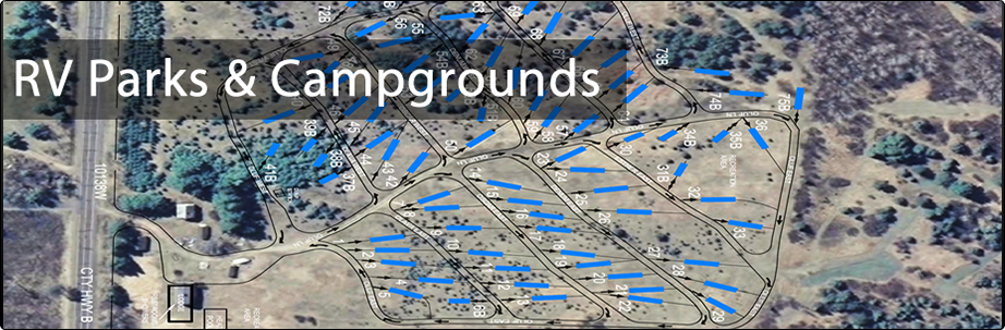
Figure 1: Subdivision & Condo Plants
Figure 2: Certified Survey Map
Figure 3: Map of Survey
Figure 4: RV Parks & Campgrounds
Figure 5: RV Parks & Campgrounds
<
>

Boundary Surveys
• Certified Survey Maps (CSM)
• Section Subdivisions
• Residential, commercial and industrial lot surveys
• ALTA/ACSM Land Title Surveys
• Condominium and Subdivision Plats
• Prepare Legal Descriptions
• Prepare Easement Descriptions
• Route Surveys
• Right-of-Way Plats
• Airport Easements
• Land Acquisition Surveys
Topographic Surveys
• Site Surveys
• Design Surveys
• Countour Mapping
• Inventory Mapping
• Volume (Stockpile) Determination
Miscellaneous Surveying Services
• GPS Control
• Aerial Photography Control
• Latitude/Longitude Determination (Tower Locations)
• Floodplain Determination
• Wetland Mapping
• Mine Surveying
Construction Surveys
• Utility Location
• As-Built Surveys
• Building Layout
• Foundation Location
• Machinery positioning
• Construction Staking
- Sewer
- Water Main
- Storm Sewer
- Road Construction
© Copyright Point North Land Surveying and Mapping Inc. All rights reserved.
CREATE A MAP

CONTACT